
I’m Melanie Petracicla Netzband, a GIS specialist and urban planner with a global perspective and a strong academic foundation. With a Master’s in Resource Efficiency in Architecture and Planning and a GIS specialization, I focus on spatial data, sustainability, and mobility to drive urban transformation. Originally from Southern Africa and now based in Germany, I’m committed to making geospatial data accessible worldwide, ensuring inclusive and sustainable urban development through digital innovation.


I am a GIS Specialist, Urban Planner, and Data Analyst with international experience in Germany, South Africa, and Mozambique, focusing on sustainable urban development, mobility research, and geospatial analytics.
With an M.Sc. in Resource Efficiency in Architecture and Planning, I specialize in GIS-based spatial analysis, business intelligence, and infrastructure optimization to drive data-informed decisions. My expertise in ArcGIS, SQL, Tableau, and sustainability consulting enables me to create innovative, technology-driven solutions for smarter cities.
LANGUAGES


M.Sc. Resource Efficiency in Architecture and Planning
- REAP
HafenCity Universität Hamburg, 2020

GIS-Specialist
GIS Akademie, 2022

B. Sc. Town and Regional Planning
Cape Peninsula University of Technology, 2011

Data Analyst
Master School, 2024
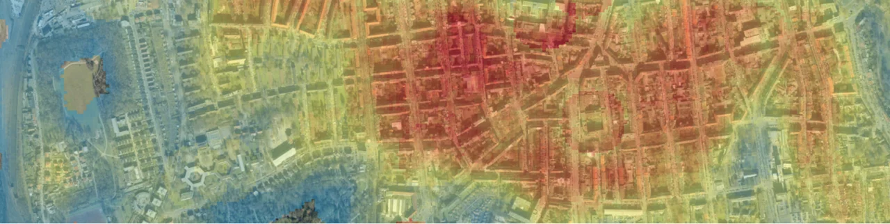
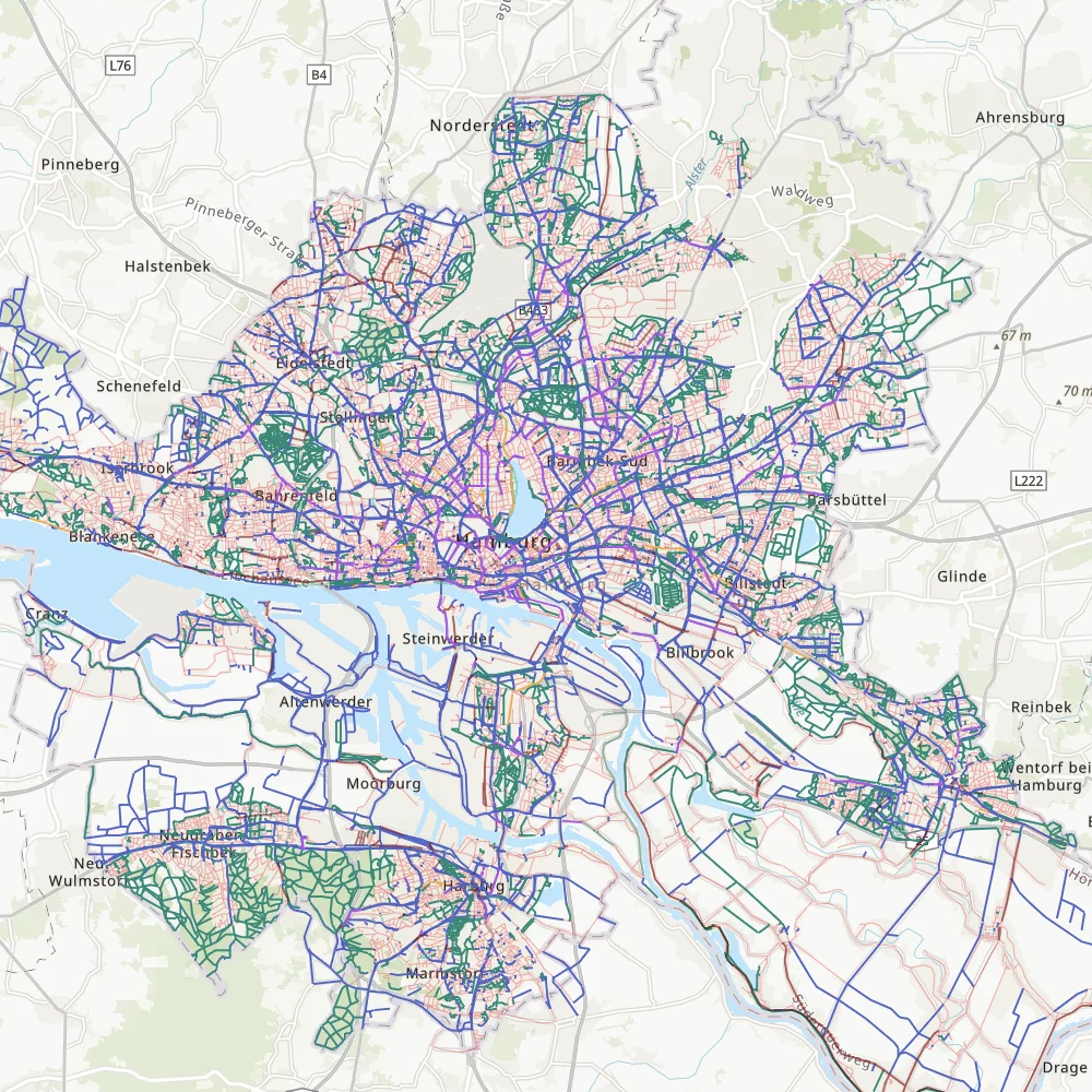
The "Radinfrastruktur Hamburg" project, conducted with BVM (Behörde für Verkehr und Mobilitätswende), leverages GIS-based spatial analysis to assess and enhance Hamburg's cycling infrastructure by focusing on accessibility, safety, and connectivity. The study highlights bicycle accident patterns across the city, identifying high-risk areas to inform safer, more efficient urban mobility planning.
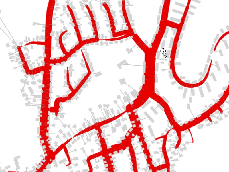
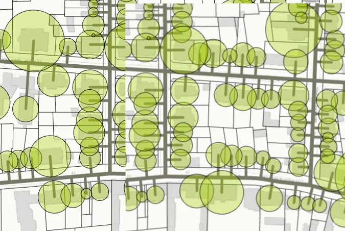
The "Urban Energy & Infrastructure GIS Analysis" repository showcases geospatial analyses and visualizations aimed at optimizing urban energy systems, district heating networks, and land-use zoning through advanced GIS and geodata techniques. These projects demonstrate the application of spatial analytics to enhance sustainable urban development and inform decision-making processes.
Through advanced GIS-based data processing and visualization techniques, these projects reveal key patterns in market trends, business metrics, and mobility, developed as part of my data analytics training with Masterschool. By leveraging statistical modeling, business intelligence tools, and cutting-edge geospatial analysis, they provide actionable structured insights to support data-driven decision-making.
Geospatial modeling, data integration, and predictive mapping play a critical role in infrastructure planning, energy optimization, and sustainable urban development. As part of a district heating project with a leading engineering and consulting firm, GIS-based spatial analysis was applied to enhance energy distribution efficiency and network resilience. The work involved spatial demand modeling, heat load forecasting, and network optimization, ensuring efficient site selection, resource allocation, and infrastructure expansion. Automated workflows in ArcGIS and SQL streamlined data processing, scenario analysis, and decision support, contributing to more sustainable and cost-effective energy solutions for urban environments.
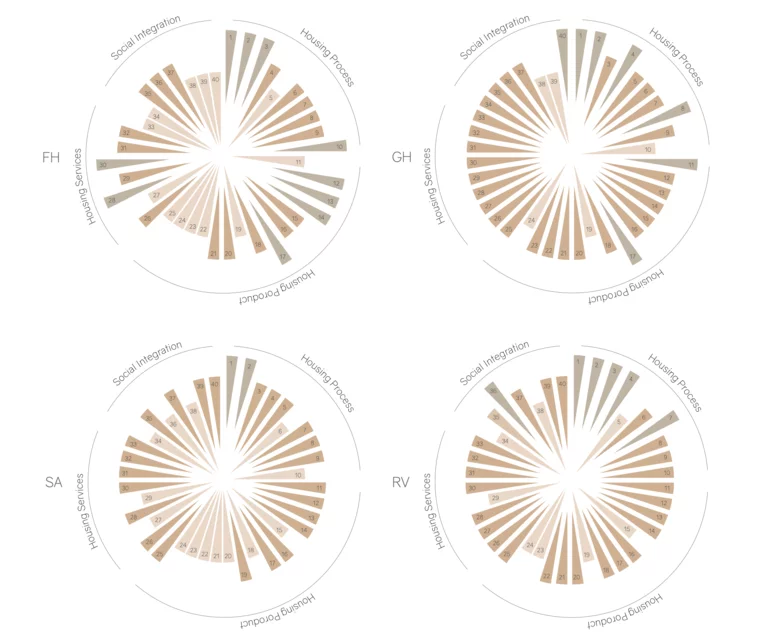
With a Master’s degree in Resource Efficiency in Architecture and Planning, my research has focused on urban housing, social integration, and participatory planning. My Master’s thesis analyzed refugee housing provision in Hamburg, evaluating how spatial integration strategies impact social inclusion.
By combining quantitative and qualitative data including site analyses, surveys, and public participation frameworks I developed a visual catalog of planning recommendations to enhance housing functionality and community engagement. My expertise lies in policy analysis, socio-spatial assessments, and mobility research, ensuring that urban development strategies are both inclusive and data-driven.
I apply GIS and data-driven methods to urban development, as seen in my bike infrastructure analysis for BVM, assessing accident patterns and accessibility gaps in Hamburg’s cycling network.
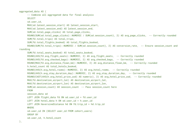
With foundational experience in data analytics and business intelligence, I apply SQL, Python, and Tableau to explore market trends, financial performance, and mobility data. Through my Masterschool training and exposure to real estate and infrastructure analytics, I have developed interactive dashboards, analyzed key performance indicators, and optimized basic data workflows. While still building deep expertise, I leverage data visualization and statistical insights to support data-driven decision-making.